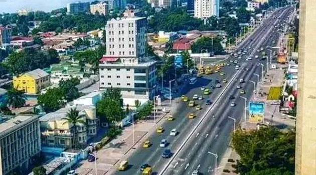
NAIROBI, Kenya, Jan 10 – An aerial image reportedly taken from Kericho’s Sinendet Towers was taken elsewhere in Democratic Republic of Congo’s Kinshasa city.
A reverse search of the image shared by blogger ‘Kijana Ya Kericho’ who enjoys a following of over 100,000 users on Facebook revealed that the aerial view represents Boulevard du Juin in central Congo.
A similar photo published via Getty Images and taken by Bloomberg’s Lisa Murray shows traffic on the Boulevard du Juin highway on November 25, 2021.

A look at cars on the highway also revealed vehicular traffic following in a direction familiar with countries with left-hand vehicles which matches DRC.
Kenya’s vehicles are predominantly right-hand drive with traffic regulations on road use requiring drivers to keep left.
The image shared by Kijana ya Kericho does not therefore represent Kericho town or its environs.